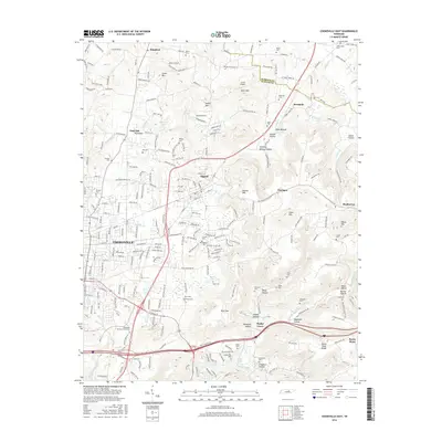
2016 Map of Cookeville East
USGS Topo · Published 2016About this map
The eastern urban fringe of Cookeville transitions into the steep ridges and hollows of the Cumberland Plateau's western edge in this 2016 record. While the city's growth extends toward Algood, the surrounding landscape is defined by traditional community anchors such as Paran Cem and Netherland Cem. The terrain is marked by prominent elevations like Algood Mtn and Buck Mtn, which drop off into numerous namesake hollows such as Chimney Springs Hollow and Pointer Hollow.
Find a feature on this map
170 named features on this map. Tap any name to fly to it.
Don’t see what you’re looking for? This feature index may not catch every label — zoom into the map to look around manually.
Map Details
Editions of this 2016 Cookeville East Map
This is the sole edition of this map. No revisions or reprints were ever made.
Other maps of this area

1897 · Standingstone
USGS Topo · 1:125,000

1898 · Standingstone
USGS Topo · 1:125,000

1925 · Gainesboro
USGS Topo · 1:62,500

1929 · Gainesboro
USGS Topo · 1:62,500

1943 · Cookeville
USGS Topo · 1:100,000

1944 · Cookeville
USGS Topo · 1:100,000

1951 · Windle
USGS Topo · 1:24,000

1953 · Cookeville East
USGS Topo · 1:24,000

1953 · Cookeville West
USGS Topo · 1:24,000
1955 · Monterey Lake
USGS Topo · 1:24,000