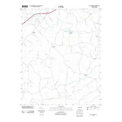
2010 Map of Cool Springs
USGS Topo · Published 2010About this map
The South Yadkin River flows across the northern reaches of this landscape, a region defined by its numerous waterways and small community clusters in the Piedmont of North Carolina. Centered around Cool Springs and Pittsburg, the area exhibits a dense network of local routes including S River Church Rd and Cool Springs Rd, which connect rural residences with nearby Mount Vernon. The presence of Scotch-Irish Plantation Lake and its accompanying Scotch-Irish Plantation Lake Dam highlights the localized water management and land use patterns of the era.
Find a feature on this map
65 named features on this map. Tap any name to fly to it.
Don’t see what you’re looking for? This feature index may not catch every label — zoom into the map to look around manually.
Map Details
Editions of this 2010 Cool Springs Map
This is the sole edition of this map. No revisions or reprints were ever made.
Other maps of this area

1893 · Statesville
USGS Topo · 1:125,000

1953 · Charlotte
USGS Topo · 1:250,000

1954 · Charlotte
USGS Topo · 1:250,000

1960 · Charlotte
USGS Topo · 1:250,000

1962 · Charlotte
USGS Topo · 1:250,000

1969 · Cooleemee
USGS Topo · 1:24,000

1969 · Cool Springs
USGS Topo · 1:24,000

1969 · Shepherds
USGS Topo · 1:24,000
1969 · Harmony
USGS Topo · 1:24,000
1969 · Mocksville
USGS Topo · 1:24,000