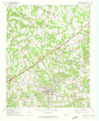
1969 Map of Mocksville
USGS Topo · Published 1972About this map
Mocksville serves as the focal point of this Davie County landscape, showing the town's expansion and infrastructure during the late 1960s. The Southern railroad corridor cuts through the territory, passing the Substation and Sewage Disposal Plant, while several local roads connect smaller outlying settlements like Cana, Maine, and Smith Grove. This period captures a transition between rural agricultural life and growing municipal development, evidenced by the presence of Rich Park and a municipal Water Tank near the town center.
Find a feature on this map
38 named features on this map. Tap any name to fly to it.
Don’t see what you’re looking for? This feature index may not catch every label — zoom into the map to look around manually.
Map Details
Editions of this 1969 Mocksville Map
3 editions found
Other maps of this area

1891 · Yadkinville
USGS Topo · 1:125,000

1893 · Statesville
USGS Topo · 1:125,000

1893 · Yadkinville
USGS Topo · 1:125,000

1950 · Churchland
USGS Topo · 1:24,000

1951 · Churchland
USGS Topo · 1:24,000

1953 · Charlotte
USGS Topo · 1:250,000

1953 · Winston-Salem
USGS Topo · 1:250,000

1954 · Charlotte
USGS Topo · 1:250,000

1955 · Winston-Salem
USGS Topo · 1:250,000

1960 · Charlotte
USGS Topo · 1:250,000