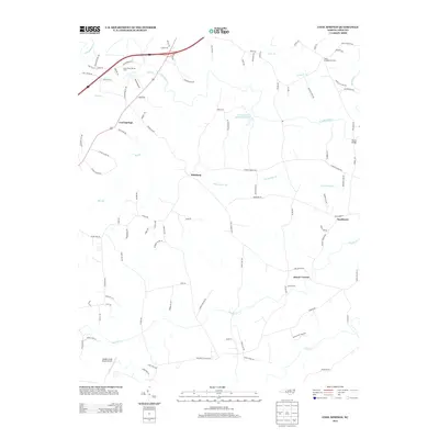
2013 Map of Cool Springs
USGS Topo · Published 2013About this map
Mount Vernon and Cool Springs anchor this portion of the North Carolina Piedmont, where the landscape is defined by the winding course of the S Yadkin River and its numerous tributaries. The map documents a predominantly rural and agricultural region, highlighted by the presence of the Dusty Road Jersey Farm and the Scotch-Irish Plantation Lake. These labels reflect the area's deep-rooted farming heritage and early Scots-Irish settlement patterns.
Find a feature on this map
98 named features on this map. Tap any name to fly to it.
Don’t see what you’re looking for? This feature index may not catch every label — zoom into the map to look around manually.
Map Details
Editions of this 2013 Cool Springs Map
This is the sole edition of this map. No revisions or reprints were ever made.
Other maps of this area

1893 · Statesville
USGS Topo · 1:125,000

1953 · Charlotte
USGS Topo · 1:250,000

1954 · Charlotte
USGS Topo · 1:250,000

1960 · Charlotte
USGS Topo · 1:250,000

1962 · Charlotte
USGS Topo · 1:250,000

1969 · Cooleemee
USGS Topo · 1:24,000

1969 · Cool Springs
USGS Topo · 1:24,000

1969 · Shepherds
USGS Topo · 1:24,000
1969 · Harmony
USGS Topo · 1:24,000
1969 · Mocksville
USGS Topo · 1:24,000