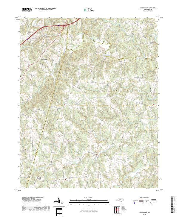
2022 Map of Cool Springs
USGS Topo · Published 2022About this map
The South Yadkin River carves the northern boundary of this Piedmont landscape, defining a region where the borders of Iredell, Davie, and Rowan counties converge. This modern survey illustrates a rural geography characterized by a network of creeks—including Fourth Creek, Third Creek, and Fifth Creek—that have influenced settlement patterns for generations. The community of Cool Springs sits at a prominent crossroads in the northwest, while smaller settlements like Mount Vernon and Needmore anchor the eastern and central reaches of the map.
Find a feature on this map
91 named features on this map. Tap any name to fly to it.
Don’t see what you’re looking for? This feature index may not catch every label — zoom into the map to look around manually.
Map Details
Editions of this 2022 Cool Springs Map
This is the sole edition of this map. No revisions or reprints were ever made.
Other maps of this area

1893 · Statesville
USGS Topo · 1:125,000

1953 · Charlotte
USGS Topo · 1:250,000

1954 · Charlotte
USGS Topo · 1:250,000

1960 · Charlotte
USGS Topo · 1:250,000

1962 · Charlotte
USGS Topo · 1:250,000

1969 · Cooleemee
USGS Topo · 1:24,000

1969 · Cool Springs
USGS Topo · 1:24,000

1969 · Shepherds
USGS Topo · 1:24,000
1969 · Harmony
USGS Topo · 1:24,000
1969 · Mocksville
USGS Topo · 1:24,000