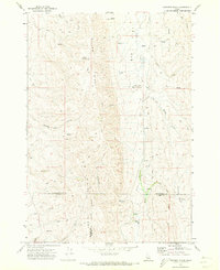
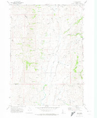
1970 Map of Coonrod Gulch
USGS Topo · Published 1973About this map
Willow Ridge dominates the center of this 1970 survey, forming a high backbone that separates the drainage systems of Big Willow Creek and North Crane Creek. This high-desert landscape in southwestern Idaho is marked by a complex network of seasonal water sources and canyons, including George Way Gulch and Davis Canyon. The presence of Butte Ranch in the southern portion of the map provides a rare point of human habitation in a region primarily defined by remote grazing land and topographical transitions.
Find a feature on this map
23 named features on this map. Tap any name to fly to it.
Don’t see what you’re looking for? This feature index may not catch every label — zoom into the map to look around manually.
Map Details
Editions of this 1970 Coonrod Gulch Map
This is the sole edition of this map. No revisions or reprints were ever made.
Other maps of this area

1894 · Squaw Creek
USGS Topo · 1:125,000

1897 · Weiser
USGS Topo · 1:125,000

1955 · Baker
USGS Topo · 1:250,000

1957 · Crane Creek Reservoir
USGS Topo · 1:62,500

1959 · Baker
USGS Topo · 1:250,000

1970 · Dodson Pass
USGS Topo · 1:24,000
1970 · Hog Cove Butte
USGS Topo · 1:24,000
1970 · Paddock Valley Reservoir
USGS Topo · 1:24,000
1970 · Squaw Butte
USGS Topo · 1:24,000
1970 · Ola
USGS Topo · 1:24,000