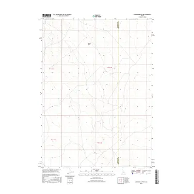
2017 Map of Coonskin Butte NE
USGS Topo · Published 2017About this map
The Bruneau Desert dominates this arid landscape at the southwestern corner of Idaho, where the high desert plateau stretches across the transition between Owyhee and Twin Falls counties. The terrain is defined by a series of subtle drainages and elevation shifts, ranging from approximately 4,200 to 4,800 feet. This 2017 survey reflects the stark, open character of the region, emphasizing the vast Public Land Survey System grid that organizes this portion of the Idaho interior. The boundary between the two counties is a primary landmark here, cutting vertically through the desert floor. This map is particularly useful for understanding modern land management and boundary alignments in a section of the state where few man-made structures exist, providing a precise record of the natural topography and political divisions that govern this remote expanse.
Find a feature on this map
6 named features on this map. Tap any name to fly to it.
Don’t see what you’re looking for? This feature index may not catch every label — zoom into the map to look around manually.
Map Details
Editions of this 2017 Coonskin Butte NE Map
This is the sole edition of this map. No revisions or reprints were ever made.
Other maps of this area

1955 · Twin Falls
USGS Topo · 1:250,000

1958 · Twin Falls
USGS Topo · 1:250,000

1959 · Buhl
USGS Topo · 1:62,500

1959 · Crows Nest
USGS Topo · 1:62,500

1964 · Roseworth
USGS Topo · 1:24,000

1965 · Tuanna Butte
USGS Topo · 1:24,000

1979 · Coonskin Butte NE
USGS Topo · 1:24,000
1979 · Roseworth
USGS Topo · 1:24,000

1979 · Coonskin Butte
USGS Topo · 1:24,000
1979 · Tuanna Butte
USGS Topo · 1:24,000