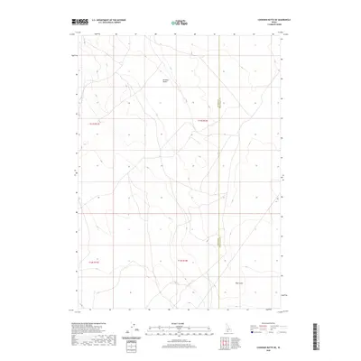
2020 Map of Coonskin Butte NE
USGS Topo · Published 2020About this map
Bruneau Desert dominates this high plateau landscape along the boundary of Owyhee and Twin Falls Counties. The area is defined by the stark topography of the high desert, where subtle drainage patterns like Blue Gulch in the southeastern corner provide the primary relief in an otherwise expansive terrain. This 2020 survey by the U.S. Geological Survey captures the remote character of this region, emphasizing the Public Land Survey System divisions such as t11s r12e and t12s r12e which organize the desert floor. The scarcity of named landmarks underscores the isolation of this corner of Idaho, where the landscape is primarily managed by the Bureau of Land Management and remains largely undeveloped, preserving a wilderness character into the twenty-first century.
Find a feature on this map
7 named features on this map. Tap any name to fly to it.
Don’t see what you’re looking for? This feature index may not catch every label — zoom into the map to look around manually.
Map Details
Editions of this 2020 Coonskin Butte NE Map
This is the sole edition of this map. No revisions or reprints were ever made.
Other maps of this area

1955 · Twin Falls
USGS Topo · 1:250,000

1958 · Twin Falls
USGS Topo · 1:250,000

1959 · Buhl
USGS Topo · 1:62,500

1959 · Crows Nest
USGS Topo · 1:62,500

1964 · Roseworth
USGS Topo · 1:24,000

1965 · Tuanna Butte
USGS Topo · 1:24,000

1979 · Coonskin Butte NE
USGS Topo · 1:24,000
1979 · Roseworth
USGS Topo · 1:24,000

1979 · Coonskin Butte
USGS Topo · 1:24,000
1979 · Tuanna Butte
USGS Topo · 1:24,000