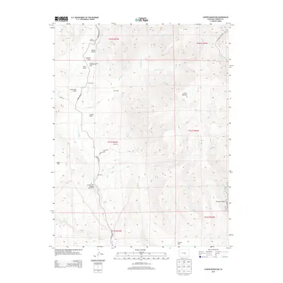
2013 Map of Cooper Mountain
USGS Topo · Published 2013About this map
Garden Park Dinosaur Monument anchors this 2013 survey of the Fremont County high country, where the landscape is defined by deep drainages and ranching operations. The topography is dominated by Cooper Mountain and the steep descents into Helena Canyon and Phantom Canyon. The area has long served as a field classroom, noted by the presence of the University of Kansas Geology Summer Camp near Espinosa Gulch. Working landscapes are prominent throughout the drainage of Fourmile Cr, with established sites such as Freek Ranch, Chess Ranch, and Dilley Ranch tracing the more level ground near the water. The canyon-cut terrain is accessed via Garden Park Rd and Phantom Canyon Rd, following the natural contours carved by Milsap Cr and its various forks.
Find a feature on this map
34 named features on this map. Tap any name to fly to it.
Don’t see what you’re looking for? This feature index may not catch every label — zoom into the map to look around manually.
Map Details
Editions of this 2013 Cooper Mountain Map
This is the sole edition of this map. No revisions or reprints were ever made.
Other maps of this area

1889 · Canon City
USGS Topo · 1:125,000

1892 · Canon City
USGS Topo · 1:125,000

1894 · Pikes Peak
USGS Topo · 1:125,000

1901 · Pikes Peak
USGS Topo · 1:125,000

1942 · Cover Mtn.
USGS Topo · 1:62,500

1948 · Cover Mtn.
USGS Topo · 1:62,500

1951 · Cripple Creek South
USGS Topo · 1:24,000

1951 · Big Bull Mountain
USGS Topo · 1:24,000

1954 · Phantom Canyon
USGS Topo · 1:24,000

1954 · Cooper Mountain
USGS Topo · 1:24,000