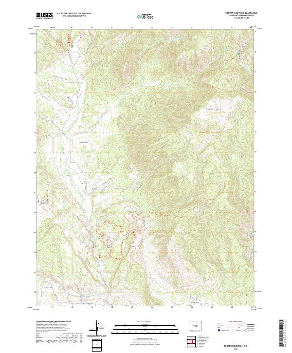
2022 Map of Cooper Mountain
USGS Topo · Published 2022About this map
Garden Park serves as a central geological and historical landmark within this portion of Fremont County, nestled between the drainage systems of Millsap Cr and Fourmile Cr. The terrain is characterized by complex gulch systems and ridges, including Espinosa Gulch and Long Gulch, which give way to the prominent elevation of Cooper Mtn in the northeast. This landscape is a significant area for geological study and recreation, evidenced by the intricate network of Bureau of Land Management routes such as the Anticline Trl, Fracture Trl, and Tectonic Shift Trl. These trails weave through the hills south of Garden Park RD, where the topography reveals the underlying structural shifts of the region. To the east, the deep incision of Phantom Canyon follows Eightmile Cr, while the southern reaches of the map open into Sixmile Park, reflecting the varied ecological and geological zones that transition through this high-altitude corridor.
Find a feature on this map
45 named features on this map. Tap any name to fly to it.
Don’t see what you’re looking for? This feature index may not catch every label — zoom into the map to look around manually.
Map Details
Editions of this 2022 Cooper Mountain Map
This is the sole edition of this map. No revisions or reprints were ever made.
Other maps of this area

1889 · Canon City
USGS Topo · 1:125,000

1892 · Canon City
USGS Topo · 1:125,000

1894 · Pikes Peak
USGS Topo · 1:125,000

1901 · Pikes Peak
USGS Topo · 1:125,000

1942 · Cover Mtn.
USGS Topo · 1:62,500

1948 · Cover Mtn.
USGS Topo · 1:62,500

1951 · Cripple Creek South
USGS Topo · 1:24,000

1951 · Big Bull Mountain
USGS Topo · 1:24,000

1954 · Phantom Canyon
USGS Topo · 1:24,000

1954 · Cooper Mountain
USGS Topo · 1:24,000