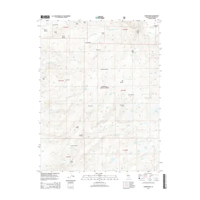
2015 Map of Cooper Peak
USGS Topo · Published 2015About this map
Stanislaus National Forest encompasses this high-elevation wilderness in Tuolumne County, dominated by a complex network of glacial lakes and drainages. The S Fork Stanislaus River flows through the northern reaches, while the southeastern section is characterized by a high concentration of water bodies including Jewelry Lake, Gem Lake, and the interestingly named Toejam Lake. The terrain is punctuated by distinctive granite features such as Castle Rock, East Flange Rock, and Burst Rock.
Find a feature on this map
64 named features on this map. Tap any name to fly to it.
Don’t see what you’re looking for? This feature index may not catch every label — zoom into the map to look around manually.
Map Details
Editions of this 2015 Cooper Peak Map
This is the sole edition of this map. No revisions or reprints were ever made.
Other maps of this area

1896 · Dardanelles
USGS Topo · 1:125,000

1898 · Dardanelles
USGS Topo · 1:125,000

1948 · Walker Lake
USGS Topo · 1:250,000

1956 · Dardanelles Cone
USGS Topo · 1:62,500

1956 · Pinecrest
USGS Topo · 1:62,500

1956 · Sonora Pass
USGS Topo · 1:62,500
1956 · Tower Peak
USGS Topo · 1:62,500

1957 · Walker Lake
USGS Topo · 1:250,000

1962 · Walker Lake
USGS Topo · 1:250,000

1964 · Walker Lake
USGS Topo · 1:250,000