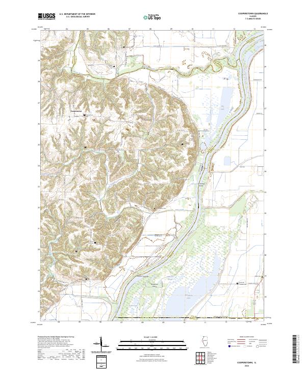
2024 Map of Cooperstown
USGS Topo · Published 2024About this map
The Illinois River and its confluence with the La Moine River define the eastern edge of this landscape, where the floodplain shifts into the dissected uplands of Brown County. The village of Cooperstown serves as a central point among a high density of rural burial grounds, including the Cooperstown Cem, Mount Zion Cem, and Vandeventer Cem, which provide significant anchor points for local genealogical research. To the south, the Meredosia National Wildlife Refuge encompasses a complex network of waterways like Hancock Slough, Twin Ponds, and the northern reaches of Meredosia Lake. This area reflects a long history of river-dependent ecosystems and drainage patterns, with named features such as La Grange Island and Moores Towhead marking the shifting nature of the river channel. Away from the water, the terrain rises into Spunky Ridge, characterized by steep drainages like Baehr Branch and Little Creek.
Find a feature on this map
75 named features on this map. Tap any name to fly to it.
Don’t see what you’re looking for? This feature index may not catch every label — zoom into the map to look around manually.
Map Details
Editions of this 2024 Cooperstown Map
This is the sole edition of this map. No revisions or reprints were ever made.
Other maps of this area

1923 · Rushville
USGS Topo · 1:62,500

1926 · Beardstown
USGS Topo · 1:62,500

1926 · Rushville
USGS Topo · 1:62,500

1928 · Meredosia
USGS Topo · 1:62,500

1929 · Arenzville
USGS Topo · 1:62,500

1931 · Meredosia
USGS Topo · 1:62,500

1932 · Arenzville
USGS Topo · 1:62,500

1944 · Beardstown
USGS Topo · 1:62,500

1948 · Quincy
USGS Topo · 1:250,000

1956 · Quincy
USGS Topo · 1:250,000