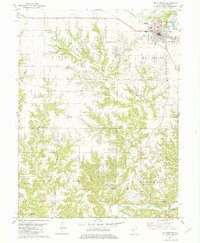
1981 Map of Mt Sterling
USGS Topo · Published 1981About this map
Mt Sterling serves as the regional hub in this 1981 survey of Brown County, Illinois, featuring the Brown Co High Sch, the local Fairground, and the Brown County Air Park. The landscape is defined by the winding course of Mc Kee Creek and its many tributaries, including Sarratt Creek and Missouri Creek. Smaller clusters of settlement and rural industry are scattered across the terrain, from the Oil Field with its numerous Oil Wells near the western border to the small community at Buckhorn. Genealogists will find a high density of family-named burial sites across the township, such as Butler Cem, Dearborn Cem, and Marden Cem. The southern edge of the quadrangle shows the riverine landscape near Two Rivers Camp and the crossing at Gerrish Bridge, providing a clear record of the rural infrastructure and land use in the early 1980s.
Find a feature on this map
40 named features on this map. Tap any name to fly to it.
Don’t see what you’re looking for? This feature index may not catch every label — zoom into the map to look around manually.
Map Details
Editions of this 1981 Mt Sterling Map
2 editions found
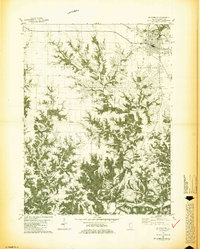
Other maps of this area

1923 · Rushville
USGS Topo · 1:62,500

1926 · Rushville
USGS Topo · 1:62,500

1926 · Mt Sterling
USGS Topo · 1:62,500

1928 · Meredosia
USGS Topo · 1:62,500

1929 · Mt Sterling
USGS Topo · 1:62,500

1931 · Meredosia
USGS Topo · 1:62,500

1946 · Augusta
USGS Topo · 1:62,500

1948 · Quincy
USGS Topo · 1:250,000

1949 · Augusta
USGS Topo · 1:62,500

1956 · Quincy
USGS Topo · 1:250,000