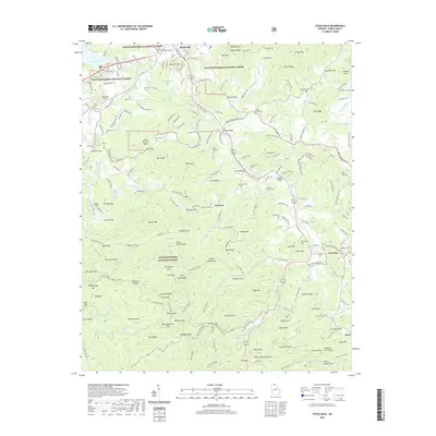
2020 Map of Coosa Bald
USGS Topo · Published 2020About this map
Blairsville serves as the focal point of this northern Georgia landscape, situated where the waters of Nottely Lake meet the drainage of Butternut Cr. The map details a transition from the town center to the dense elevations of the Chattahoochee National Forest, where landmarks like Beasley Knob and Wellborn Mtn overlook the valley. Settlement patterns follow the winding course of the Nottely River and its tributaries, such as Arkaqua Cr and Wolf Cr. Genealogists will find a high density of rural burial grounds, including the Old Liberty Cem, Choestoe Cem, and Shady Grove Cem. Further south, the terrain becomes more dramatic near Lake Trahlyta and the Helton Creek Falls, reflecting the geography of the Blue Ridge foothills. Small communities like Choestoe and Owltown anchor the secondary valleys, connected by a network of gap roads like Old Bald Mountain Rd and Rich Gap Rd.
Find a feature on this map
220 named features on this map. Tap any name to fly to it.
Don’t see what you’re looking for? This feature index may not catch every label — zoom into the map to look around manually.
Map Details
Editions of this 2020 Coosa Bald Map
This is the sole edition of this map. No revisions or reprints were ever made.
Other maps of this area

1886 · Dahlonega
USGS Topo · 1:125,000

1888 · Ellijay
USGS Topo · 1:125,000

1892 · Dahlonega
USGS Topo · 1:125,000

1892 · Ellijay
USGS Topo · 1:125,000

1896 · Dahlonega
USGS Topo · 1:125,000

1898 · Ellijay
USGS Topo · 1:125,000

1903 · Dahlonega
USGS Topo · 1:125,000

1911 · Ellijay
USGS Topo · 1:125,000

1935 · Coosa Bald
USGS Topo · 1:24,000

1935 · Ivylog
USGS Topo · 1:24,000