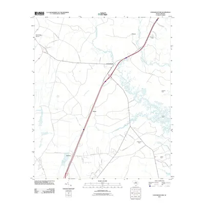
2011 Map of Coosawhatchie
USGS Topo · Published 2011About this map
The Coosawhatchie River and its intricate tidal tributaries dominate this Lowcountry landscape in Jasper County, South Carolina. The settlement of Coosawhatchie serves as a central point where transportation corridors converge, including a major interstate and local routes like Gilmania Rd. The surrounding terrain is defined by numerous necks and islands, such as Grahams Neck, Gregorie Neck, and Dawson Island, which reveal the historical reliance on these natural landforms for navigation and boundary marking.
Find a feature on this map
40 named features on this map. Tap any name to fly to it.
Don’t see what you’re looking for? This feature index may not catch every label — zoom into the map to look around manually.
Map Details
Editions of this 2011 Coosawhatchie Map
This is the sole edition of this map. No revisions or reprints were ever made.
Other maps of this area

1918 · Yemassee
USGS Topo · 1:62,500

1919 · Pineland
USGS Topo · 1:62,500

1920 · Hardeeville
USGS Topo · 1:62,500

1920 · Okatie
USGS Topo · 1:62,500

1942 · Okatie
USGS Topo · 1:62,500

1943 · Pineland
USGS Topo · 1:62,500

1943 · Hardeeville
USGS Topo · 1:62,500

1943 · Yemassee
USGS Topo · 1:62,500

1947 · Savannah
USGS Topo · 1:250,000

1948 · Savannah
USGS Topo · 1:250,000