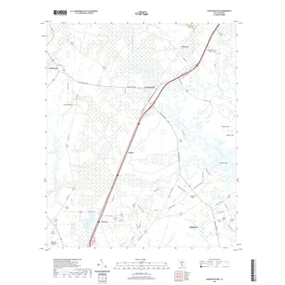
2020 Map of Coosawhatchie
USGS Topo · Published 2020About this map
The Coosawhatchie River and its intricate wetlands define this South Carolina landscape, where historic settlements like Coosawhatchie and Gillisonville reflect the long-standing habitation of Jasper County. The map details a transition from the agricultural and timber-linked tracts of Gregorie Neck and Huguenins Neck to the modern transportation corridors of Interstate 95. Evidence of the region’s plantation history is visible through labels like Moultrie Plantation and Roseland Plantation Dr. Smaller communities such as Bashan, Ricetown, and Gilmania are documented alongside local landmarks like Deloss Point and the Ridgeland-Claude Dean Airport. The drainage patterns of Little Bees Creek and the Tulifiny River reveal the low-lying, water-dominant geography that has historically shaped travel and land use in this coastal plain region.
Find a feature on this map
53 named features on this map. Tap any name to fly to it.
Don’t see what you’re looking for? This feature index may not catch every label — zoom into the map to look around manually.
Map Details
Editions of this 2020 Coosawhatchie Map
This is the sole edition of this map. No revisions or reprints were ever made.
Other maps of this area

1918 · Yemassee
USGS Topo · 1:62,500

1919 · Pineland
USGS Topo · 1:62,500

1920 · Hardeeville
USGS Topo · 1:62,500

1920 · Okatie
USGS Topo · 1:62,500

1942 · Okatie
USGS Topo · 1:62,500

1943 · Pineland
USGS Topo · 1:62,500

1943 · Hardeeville
USGS Topo · 1:62,500

1943 · Yemassee
USGS Topo · 1:62,500

1947 · Savannah
USGS Topo · 1:250,000

1948 · Savannah
USGS Topo · 1:250,000