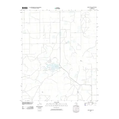
2010 Map of Cope Creek
USGS Topo · Published 2010About this map
Tule Creek Lake serves as a central geographic anchor for this High Plains landscape, held by the MacKenzie Dam where several seasonal watercourses converge. The surrounding terrain is defined by a sparse network of county roads and established agricultural operations, including the Flowers Ranch, Martin Ranch, and Mayfield Ranch. These large landholdings reflect the enduring ranching economy of Briscoe County. Topographical interest is concentrated along the winding paths of Cope Creek and Rock Creek, which cut through the level caprock. A notable landform known as The Narrows appears along the eastern reaches of Tule Creek, marking a transition in the local drainage pattern where the water begins its descent from the plateau. The map details the modern infrastructure of the early 2000s, showing the intersection of FM 3300 and N MacKenzie Rd providing access to the reservoir.
Find a feature on this map
25 named features on this map. Tap any name to fly to it.
Don’t see what you’re looking for? This feature index may not catch every label — zoom into the map to look around manually.
Map Details
Editions of this 2010 Cope Creek Map
This is the sole edition of this map. No revisions or reprints were ever made.
Other maps of this area

1954 · Plainview
USGS Topo · 1:250,000

1958 · Plainview
USGS Topo · 1:250,000

1965 · Ross Canyon
USGS Topo · 1:24,000

1965 · Big Betty Reservoir
USGS Topo · 1:24,000

1965 · Silverton
USGS Topo · 1:24,000

1965 · Rock Creek
USGS Topo · 1:24,000

1965 · Vigo Park
USGS Topo · 1:24,000

1965 · Cope Creek
USGS Topo · 1:24,000

1969 · Love
USGS Topo · 1:24,000

1969 · Jackson Hill
USGS Topo · 1:24,000