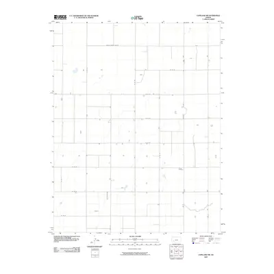
2009 Map of Copeland NW
USGS Topo · Published 2009About this map
Colusa Cemetery stands as a primary point of historical interest within this section of Finney County, marking a site of long-standing local significance amidst the vast agricultural grid of southwest Kansas. The landscape is structured by an orderly network of section-line roads, including the Haskell County Line Rd at the northern boundary and Tice St to the southeast. These roads, such as Co Rd 1 and Co Rd 50, serve the rural homesteads and farmsteads that punctuate the plains. The terrain is characterized by subtle drainage patterns and occasional depressions, typical of the high plains environment. This survey captures the region as it transitioned into the early 21st century, showing the persistent rural settlement pattern where property boundaries and travel routes have remained remarkably consistent over decades of agricultural use.
Find a feature on this map
16 named features on this map. Tap any name to fly to it.
Don’t see what you’re looking for? This feature index may not catch every label — zoom into the map to look around manually.
Map Details
Editions of this 2009 Copeland NW Map
This is the sole edition of this map. No revisions or reprints were ever made.
Other maps of this area

1896 · Garden
USGS Topo · 1:125,000

1955 · Dodge City
USGS Topo · 1:250,000

1958 · Dodge City
USGS Topo · 1:250,000

1959 · Dodge City
USGS Topo · 1:250,000

1959 · Garden City 3 NE
USGS Topo · 1:24,000

1960 · Garden City 3 SE
USGS Topo · 1:24,000

1960 · Plymell
USGS Topo · 1:24,000

1967 · Pierceville SW
USGS Topo · 1:24,000
1968 · Charleston
USGS Topo · 1:24,000
1969 · Copeland SE
USGS Topo · 1:24,000