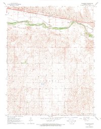
1968 Map of Charleston
USGS Topo · Published 1969About this map
Arkansas River waters and the high plains of Gray County define this late-1960s landscape, where the braided river channel cuts a distinct path through the surrounding terrain. The settlement of Charleston serves as the focal point for the northern portion of the map, situated along the vital Atchison Topeka and Santa Fe railroad corridor. This rail line provided the essential connection for the transport of agricultural goods and local resources from the heart of the Great Plains.
Find a feature on this map
8 named features on this map. Tap any name to fly to it.
Don’t see what you’re looking for? This feature index may not catch every label — zoom into the map to look around manually.
Map Details
Editions of this 1968 Charleston Map
This is the sole edition of this map. No revisions or reprints were ever made.
Other maps of this area

1892 · Dodge
USGS Topo · 1:125,000

1896 · Garden
USGS Topo · 1:125,000

1955 · Dodge City
USGS Topo · 1:250,000

1958 · Dodge City
USGS Topo · 1:250,000

1959 · Dodge City
USGS Topo · 1:250,000

1967 · Pierceville SW
USGS Topo · 1:24,000

1967 · Pierceville
USGS Topo · 1:24,000

1968 · Cimarron NW
USGS Topo · 1:24,000

1968 · Ingalls
USGS Topo · 1:24,000

1968 · Montezuma NW
USGS Topo · 1:24,000