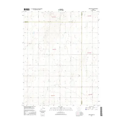
2016 Map of Copeland NW
USGS Topo · Published 2016About this map
High plains agriculture and a strictly organized section-line grid define this landscape along the borders of Finney, Haskell, and Gray Counties. The terrain is notably flat, punctuated by the Colusa Cem and a dense network of local routes like Haskell Co Line Rd and S Hutton Rd. This 2016 survey reflects the modern geometry of the Kansas prairie, where the rural economy is etched into the earth through an alphabetical and numerical road system, including T Rd and U Rd. The map provides a precise record of property boundaries and land management in the southwestern part of the state, centered on the intersection of several townships including t27s r31w.
Find a feature on this map
34 named features on this map. Tap any name to fly to it.
Don’t see what you’re looking for? This feature index may not catch every label — zoom into the map to look around manually.
Map Details
Editions of this 2016 Copeland NW Map
This is the sole edition of this map. No revisions or reprints were ever made.
Other maps of this area

1896 · Garden
USGS Topo · 1:125,000

1955 · Dodge City
USGS Topo · 1:250,000

1958 · Dodge City
USGS Topo · 1:250,000

1959 · Dodge City
USGS Topo · 1:250,000

1959 · Garden City 3 NE
USGS Topo · 1:24,000

1960 · Garden City 3 SE
USGS Topo · 1:24,000

1960 · Plymell
USGS Topo · 1:24,000

1967 · Pierceville SW
USGS Topo · 1:24,000
1968 · Charleston
USGS Topo · 1:24,000
1969 · Copeland SE
USGS Topo · 1:24,000