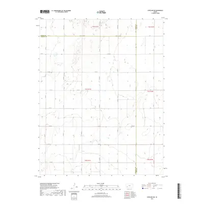
2018 Map of Copeland NW
USGS Topo · Published 2018About this map
Colusa Cem sits near the intersection of Co Rd 60 and Co Rd 1, marking a significant historical point in this rural landscape. This portion of the High Plains is defined by a strict grid of section roads and the convergence of three different administrative territories. The meeting point of Finney County, Haskell County, and Gray County creates a unique geographic tri-point where the Haskell Co Line Rd serves as a primary boundary marker.
Find a feature on this map
36 named features on this map. Tap any name to fly to it.
Don’t see what you’re looking for? This feature index may not catch every label — zoom into the map to look around manually.
Map Details
Editions of this 2018 Copeland NW Map
This is the sole edition of this map. No revisions or reprints were ever made.
Other maps of this area

1896 · Garden
USGS Topo · 1:125,000

1955 · Dodge City
USGS Topo · 1:250,000

1958 · Dodge City
USGS Topo · 1:250,000

1959 · Dodge City
USGS Topo · 1:250,000

1959 · Garden City 3 NE
USGS Topo · 1:24,000

1960 · Garden City 3 SE
USGS Topo · 1:24,000

1960 · Plymell
USGS Topo · 1:24,000

1967 · Pierceville SW
USGS Topo · 1:24,000
1968 · Charleston
USGS Topo · 1:24,000
1969 · Copeland SE
USGS Topo · 1:24,000