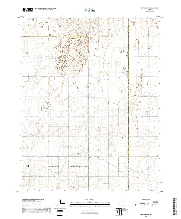
2022 Map of Copeland NW
USGS Topo · Published 2022About this map
The Colusa Cem serves as a central historical landmark in this section of the High Plains, where the borders of Finney, Haskell, and Gray counties meet. This 2022 survey illustrates the strict grid of the Public Land Survey System, a landscape defined by section lines and agricultural access roads like Haskell Co Line Rd and S Beefland Rd. The terrain is marked by numerous depressions and intermittent wetlands, characteristic of the region's playa lakes, which dot the township divisions of t27s r31w and t27s r30w. These natural features disrupt the otherwise rigid geometry of the local transit network, including north-south corridors such as S Pierceville Rd and S Hutton Rd.
Find a feature on this map
36 named features on this map. Tap any name to fly to it.
Don’t see what you’re looking for? This feature index may not catch every label — zoom into the map to look around manually.
Map Details
Editions of this 2022 Copeland NW Map
This is the sole edition of this map. No revisions or reprints were ever made.
Other maps of this area

1896 · Garden
USGS Topo · 1:125,000

1955 · Dodge City
USGS Topo · 1:250,000

1958 · Dodge City
USGS Topo · 1:250,000

1959 · Dodge City
USGS Topo · 1:250,000

1959 · Garden City 3 NE
USGS Topo · 1:24,000

1960 · Garden City 3 SE
USGS Topo · 1:24,000

1960 · Plymell
USGS Topo · 1:24,000

1967 · Pierceville SW
USGS Topo · 1:24,000
1968 · Charleston
USGS Topo · 1:24,000
1969 · Copeland SE
USGS Topo · 1:24,000