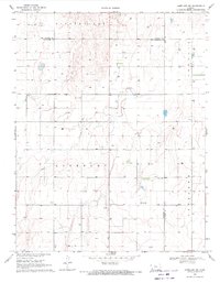
1969 Map of Copeland NW
USGS Topo · Published 1971About this map
Haskell County and Finney County converge in this high-plains landscape, where the agricultural grid of the late 1960s is punctuated by specialized land use and community hubs. The survey documents a largely rural expanse divided between the townships of Pierceville, Lockport, Ingalls, and Copeland. Local social life and faith are anchored at the Salem Ch and the nearby Community Hall, providing a clear look at the decentralized settlement pattern of western Kansas during this era.
Find a feature on this map
11 named features on this map. Tap any name to fly to it.
Don’t see what you’re looking for? This feature index may not catch every label — zoom into the map to look around manually.
Map Details
Editions of this 1969 Copeland NW Map
This is the sole edition of this map. No revisions or reprints were ever made.
Other maps of this area

1896 · Garden
USGS Topo · 1:125,000

1955 · Dodge City
USGS Topo · 1:250,000

1958 · Dodge City
USGS Topo · 1:250,000

1959 · Dodge City
USGS Topo · 1:250,000

1959 · Garden City 3 NE
USGS Topo · 1:24,000

1960 · Garden City 3 SE
USGS Topo · 1:24,000

1960 · Plymell
USGS Topo · 1:24,000

1967 · Pierceville SW
USGS Topo · 1:24,000
1968 · Charleston
USGS Topo · 1:24,000
1969 · Copeland SE
USGS Topo · 1:24,000