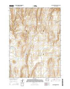
2014 Map of Copeland Reservoirs
USGS Topo · Published 2014About this map
Copeland Butte rises above an arid landscape dominated by an intricate system of water management in Malheur County. This 2014 survey reveals a high-desert environment where stock water is carefully captured in numerous small basins such as Robinson Reservoir, Esplin Reservoir, and Car Reservoir. The terrain is characterized by broad, low-lying areas like Antelope Flat and Little Mud Flat, which are bisected by seasonal drainages including Butte Cr and Wildcat Cr. Transportation is limited to isolated corridors like Crowley Rd and Antelope Flat Rd, reflecting the remote ranching character of this region. The density of named catchments, from the Antelope Flat Reservoir Number One to the Butte Waterhole Reservoir, underscores the vital importance of surface water resources for land use in this corner of eastern Oregon.
Find a feature on this map
31 named features on this map. Tap any name to fly to it.
Don’t see what you’re looking for? This feature index may not catch every label — zoom into the map to look around manually.
Map Details
Editions of this 2014 Copeland Reservoirs Map
This is the sole edition of this map. No revisions or reprints were ever made.
Other maps of this area

1955 · Boise
USGS Topo · 1:250,000

1958 · Boise
USGS Topo · 1:250,000

1962 · Boise
USGS Topo · 1:250,000

1972 · Cedar Mountain
USGS Topo · 1:24,000

1972 · Burnt Flat
USGS Topo · 1:24,000

1972 · Big Mud Flat
USGS Topo · 1:24,000
1972 · Wall Rock Springs
USGS Topo · 1:24,000

1972 · Alder Creek
USGS Topo · 1:24,000

1972 · Rufino Butte
USGS Topo · 1:24,000

1972 · Copeland Reservoirs
USGS Topo · 1:24,000