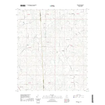
2018 Map of Copeland
USGS Topo · Published 2018About this map
Mehaffey, Belmont, and Copeland anchor this survey of the Alabama-Mississippi borderlands, where the terrain is defined by the winding course of the Escatawpa River. The landscape is heavily marked by a high density of rural burial grounds, including Zion Rest Cem, Minerva Cem, and Lewis Chapel Cem, suggesting a long-established network of family and church-centered settlements across Washington County, Alabama, and Wayne County, Mississippi. A complex grid of local roads and logging tracks, such as Buckatunna Millry Rd and Copeland Buckatunna Rd, connects these isolated communities and follows the natural drainage of numerous tributaries like Little Red Cr and Savannah Br. The proximity of these small hamlets to the state line highlights the historical importance of cross-border local transit in this timber-rich region of the Gulf Coastal Plain.
Find a feature on this map
76 named features on this map. Tap any name to fly to it.
Don’t see what you’re looking for? This feature index may not catch every label — zoom into the map to look around manually.
Map Details
Editions of this 2018 Copeland Map
This is the sole edition of this map. No revisions or reprints were ever made.
Other maps of this area

1953 · Hattiesburg
USGS Topo · 1:250,000

1958 · Hattiesburg
USGS Topo · 1:250,000

1964 · Denham
USGS Topo · 1:24,000

1964 · Knobtown
USGS Topo · 1:24,000

1964 · Buckatunna
USGS Topo · 1:24,000

1974 · Millry South
USGS Topo · 1:24,000

1974 · Chatom
USGS Topo · 1:24,000

1974 · State Line
USGS Topo · 1:24,000

1974 · Millry North
USGS Topo · 1:24,000

1974 · Copeland
USGS Topo · 1:24,000