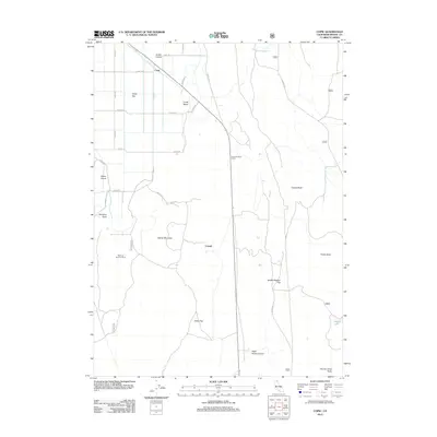
2012 Map of Copic
USGS Topo · Published 2012About this map
Battle of Lands Ranch and Battle of Scorpion Point highlight a legacy of conflict in this high desert landscape of Modoc County. The terrain is a complex arrangement of volcanic buttes and seasonal flats, where water is the primary organizer of settlement and history. Small outposts like Cornell and Copic sit along the corridors defined by Co Rd 138 and Co Rd 114, serving the surrounding ranching country. The northern reaches are characterized by specialized landforms such as Snake Island and Lands Island, which rise from the dry lake beds and basins. This corner of California shows a distinct pattern of human endurance, from the historical military engagements to the modern management of water at Mason Reservoir and Harvey Lake, illustrating how the arid environment of Copic Bay has dictated movement and residency for generations.
Find a feature on this map
37 named features on this map. Tap any name to fly to it.
Don’t see what you’re looking for? This feature index may not catch every label — zoom into the map to look around manually.
Map Details
Editions of this 2012 Copic Map
This is the sole edition of this map. No revisions or reprints were ever made.
Other maps of this area
1886 · Modoc Lava Bed
USGS Topo · 1:250,000
1892 · Modoc Lava-Bed
USGS Topo · 1:250,000
1951 · Clear Lake Reservoir
USGS Topo · 1:62,500
1951 · Tulelake
USGS Topo · 1:62,500
1952 · Timber Mountain
USGS Topo · 1:62,500
1952 · Hackamore
USGS Topo · 1:62,500
1954 · Alturas
USGS Topo · 1:250,000
1958 · Alturas
USGS Topo · 1:250,000
1962 · Alturas
USGS Topo · 1:250,000
1965 · Alturas
USGS Topo · 1:250,000