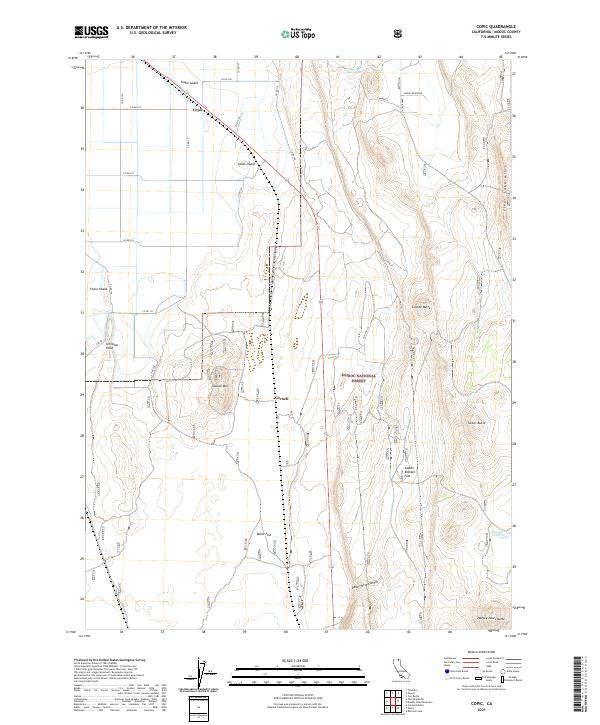
2021 Map of Copic
USGS Topo · Published 2021About this map
Modoc National Forest land dominates this high-desert region of Modoc County, where the transition from irrigated valley flats to volcanic uplands is clearly visible. The small settlement of Cornell sits along the primary highway corridor, serving as a focal point for a landscape defined by its distinct volcanic topography. To the north, the former rail and road junction at Copic marks the edge of a drainage system that includes Snake Island and Lands Island, names that hint at the seasonal water patterns and historical land use of the Tule Lake basin area.
Find a feature on this map
37 named features on this map. Tap any name to fly to it.
Don’t see what you’re looking for? This feature index may not catch every label — zoom into the map to look around manually.
Map Details
Editions of this 2021 Copic Map
This is the sole edition of this map. No revisions or reprints were ever made.
Other maps of this area

1886 · Modoc Lava Bed
USGS Topo · 1:250,000

1892 · Modoc Lava-Bed
USGS Topo · 1:250,000

1951 · Clear Lake Reservoir
USGS Topo · 1:62,500

1951 · Tulelake
USGS Topo · 1:62,500

1952 · Timber Mountain
USGS Topo · 1:62,500

1952 · Hackamore
USGS Topo · 1:62,500

1954 · Alturas
USGS Topo · 1:250,000

1958 · Alturas
USGS Topo · 1:250,000

1962 · Alturas
USGS Topo · 1:250,000

1965 · Alturas
USGS Topo · 1:250,000