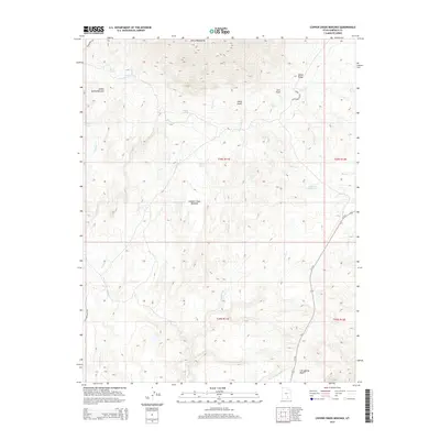
2014 Map of Copper Creek Benches
USGS Topo · Published 2014About this map
The Henry Mountains dominate the northern horizon of this landscape, casting their influence over a network of high-elevation plateaus and drainages. The topography is defined by the broad Indian Spring Benches and Copper Creek Benches, which transition into a series of distinctive landforms including Johns Knoll, Juds Knoll, and the sharp prominence of the Black Cockcomb. Water is the primary architect here, with ephemeral systems like Shitamaring Cr and Lost Spring Wash carving deep into the earth, supported by vital points such as Indian Spring and Star Spring. In the northeast, Milk Cr Reservoir and the drainage of Milk Cr indicate localized water management efforts in this arid territory. The lone modern artery, Ut-276, cuts across the southeastern corner, providing a singular point of access through this complex terrain of ridges and washes.
Find a feature on this map
27 named features on this map. Tap any name to fly to it.
Don’t see what you’re looking for? This feature index may not catch every label — zoom into the map to look around manually.
Map Details
Editions of this 2014 Copper Creek Benches Map
This is the sole edition of this map. No revisions or reprints were ever made.
Other maps of this area

1886 · Henry Mountains
USGS Topo · 1:250,000

1892 · Henry Mountains
USGS Topo · 1:250,000

1952 · Mt Pennell 1 SW
USGS Topo · 1:24,000

1952 · Mt Pennell 2 NE
USGS Topo · 1:24,000

1952 · Mt Pennell 1 NE
USGS Topo · 1:24,000

1952 · Mt Hillers
USGS Topo · 1:62,500

1952 · Mt Pennell 1 SE
USGS Topo · 1:24,000

1952 · Mt Pennell 1 NW
USGS Topo · 1:24,000

1953 · Mt Pennell
USGS Topo · 1:62,500

1953 · Mt Pennell 2 SE
USGS Topo · 1:24,000