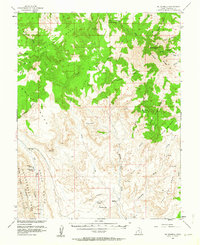
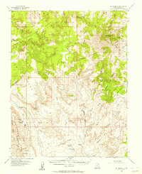
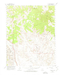
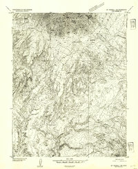
1953 Map of Mt Pennell
USGS Topo · Published 1953About this map
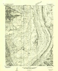
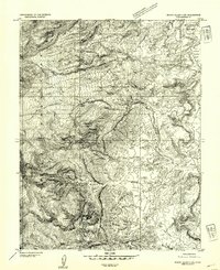
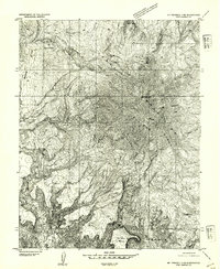
The Henry Mountains rise prominently in this 1953 survey, dominated by the peak of Mt Pennell. This landscape, mapped with cooperation from the Atomic Energy Commission, reflects an era of intense geological scrutiny in Garfield County. The rugged topography is defined by the massive uplift of the Waterpocket Fold and the deep dissection of Grand Gulch. To the west, the Circle Cliffs form a dramatic boundary, while the high elevations of Tarantula Mesa and Swap Mesa illustrate the region's complex plateau structure.
Find a feature on this map
40 named features on this map. Tap any name to fly to it.
Don’t see what you’re looking for? This feature index may not catch every label — zoom into the map to look around manually.
Map Details
Editions of this 1953 Mt Pennell Map
3 editions found
Other maps of this area

1885 · San Rafael
USGS Topo · 1:250,000

1885 · Fish Lake
USGS Topo · 1:250,000

1886 · Escalante
USGS Topo · 1:250,000

1886 · Henry Mountains
USGS Topo · 1:250,000

1892 · Henry Mountains
USGS Topo · 1:250,000

1896 · Fish Lake
USGS Topo · 1:250,000
1952 · Mt Pennell 1 SW
USGS Topo · 1:24,000
1952 · Notom 4 SE
USGS Topo · 1:24,000
1952 · Mount Ellen 4 SW
USGS Topo · 1:24,000
1952 · Mt Pennell 2 NE
USGS Topo · 1:24,000