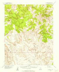
1953 Map of Mt Pennell
USGS Topo · Published 1957About this map
Mt Pennell anchors this mid-century survey of the Henry Mts, where the landscape transitions from high peaks like The Horn down to the distinct geologic upheaval of the Waterpocket Fold. The isolation of the era is evident in the sparse infrastructure, consisting largely of unimproved dirt roads and light-duty trails connecting remote outposts like The Post. Water sources, critical for survival and travel in the Garfield County backcountry, are carefully documented through series of natural reservoirs and seeps including Willow Tanks, Cottonwood Tanks, and Jackass Spring. Industrial activity is represented by the Stanton Mine located near Coal Bed Mesa, while the colorful local nomenclature of the region is preserved in labels such as Eggnog, Saleratus Wash, and the prominent Tarantula Mesa to the northwest.
Find a feature on this map
47 named features on this map. Tap any name to fly to it.
Don’t see what you’re looking for? This feature index may not catch every label — zoom into the map to look around manually.
Map Details
Editions of this 1953 Mt Pennell Map
3 editions found

Other maps of this area

1885 · San Rafael
USGS Topo · 1:250,000

1885 · Fish Lake
USGS Topo · 1:250,000

1886 · Escalante
USGS Topo · 1:250,000

1886 · Henry Mountains
USGS Topo · 1:250,000

1892 · Henry Mountains
USGS Topo · 1:250,000

1896 · Fish Lake
USGS Topo · 1:250,000

1952 · Mt Pennell 1 SW
USGS Topo · 1:24,000

1952 · Notom 4 SE
USGS Topo · 1:24,000

1952 · Mount Ellen 4 SW
USGS Topo · 1:24,000

1952 · Mt Pennell 2 NE
USGS Topo · 1:24,000