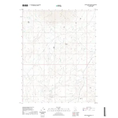
2020 Map of Copper Creek Benches
USGS Topo · Published 2020About this map
The Henry Mountains and the northern reaches of the Little Rockies dominate this Garfield County landscape, characterized by complex drainage systems and isolated high points. The map details a high-desert environment where water sources are vital landmarks, evidenced by named springs such as Indian Spring, Papoose Spring, and Chucker Spring. The central drainage of Copper Cr gives way to the broad, elevated Copper Creek Benches, a distinctive geological formation that provides a natural corridor between the mountain ranges. Further east, the Milk Cr Reservoir serves as a significant hydrologic feature in an otherwise arid region. The presence of numerous family-named peaks like Johns Knoll and Juds Knoll suggests the historical importance of these heights for navigation and livestock management across the Indian Spring Benches.
Find a feature on this map
21 named features on this map. Tap any name to fly to it.
Don’t see what you’re looking for? This feature index may not catch every label — zoom into the map to look around manually.
Map Details
Editions of this 2020 Copper Creek Benches Map
This is the sole edition of this map. No revisions or reprints were ever made.
Other maps of this area

1886 · Henry Mountains
USGS Topo · 1:250,000

1892 · Henry Mountains
USGS Topo · 1:250,000

1952 · Mt Pennell 1 SW
USGS Topo · 1:24,000

1952 · Mt Pennell 2 NE
USGS Topo · 1:24,000

1952 · Mt Pennell 1 NE
USGS Topo · 1:24,000

1952 · Mt Hillers
USGS Topo · 1:62,500

1952 · Mt Pennell 1 SE
USGS Topo · 1:24,000

1952 · Mt Pennell 1 NW
USGS Topo · 1:24,000

1953 · Mt Pennell
USGS Topo · 1:62,500

1953 · Mt Pennell 2 SE
USGS Topo · 1:24,000