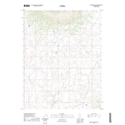
2023 Map of Copper Creek Benches
USGS Topo · Published 2023About this map
The Henry Mountains dominate this Garfield County landscape, characterized by the dramatic elevation changes and arid drainage systems of southeastern Utah. In this modern survey, the intricate network of canyons and plateaus is defined by features like the Copper Creek Benches and the Indian Spring Benches, which highlight the stepped topography typical of the region's erosional geology. Water is the primary architect of the land here, evidenced by the convergence of Copper Creek, Shitamaring Creek, and Hansen Creek as they cut through the high desert. Localized water sources, including Star Spring, Copper Spring, and the Milk Cr Reservoir, indicate the sparse but vital resources managed for livestock and wildlife. Along the eastern edge, the topography descends toward the Little Rockies and the extensive Lost Spring Wash, revealing a transition from alpine heights to low-lying drainage basins.
Find a feature on this map
21 named features on this map. Tap any name to fly to it.
Don’t see what you’re looking for? This feature index may not catch every label — zoom into the map to look around manually.
Map Details
Editions of this 2023 Copper Creek Benches Map
This is the sole edition of this map. No revisions or reprints were ever made.
Other maps of this area

1886 · Henry Mountains
USGS Topo · 1:250,000

1892 · Henry Mountains
USGS Topo · 1:250,000

1952 · Mt Pennell 1 SW
USGS Topo · 1:24,000

1952 · Mt Pennell 2 NE
USGS Topo · 1:24,000

1952 · Mt Pennell 1 NE
USGS Topo · 1:24,000

1952 · Mt Hillers
USGS Topo · 1:62,500

1952 · Mt Pennell 1 SE
USGS Topo · 1:24,000

1952 · Mt Pennell 1 NW
USGS Topo · 1:24,000

1953 · Mt Pennell
USGS Topo · 1:62,500

1953 · Mt Pennell 2 SE
USGS Topo · 1:24,000