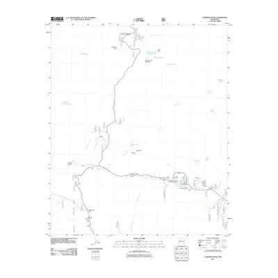
2011 Map of Copperas Peak
USGS Topo · Published 2011About this map
Meerschaum Mine and the Little Victor Tunnel anchor the central portion of this high-desert landscape, signaling the area's mineral history. The southern region is defined by the waters of Sapillo Creek and the Lake Roberts Dam, which created a recreational hub featuring the Mesa Campground and Lake Roberts Campground. The terrain is characterized by dramatic elevations like Copperas Peak and Buck Hannen Mountain, while water management is evident through a network of remote tanks such as Corral Tank and Thirtytwo Tank. Significant viewpoints, including the Senator Clinton P Anderson Wilderness Overlook and the Austin Roberts Vista/Point of Interest, highlight the area's importance as a preserved natural corridor. The map details the transition from the high ridges of Wild Horse Mesa to the deep incisions of Meerschaum Canyon.
Find a feature on this map
36 named features on this map. Tap any name to fly to it.
Don’t see what you’re looking for? This feature index may not catch every label — zoom into the map to look around manually.
Map Details
Editions of this 2011 Copperas Peak Map
This is the sole edition of this map. No revisions or reprints were ever made.
Other maps of this area

1909 · Silver City
USGS Topo · 1:125,000

1911 · Alum Mountain
USGS Topo · 1:125,000

1913 · Alum Mountain
USGS Topo · 1:125,000

1947 · Allie Canyon
USGS Topo · 1:24,000

1947 · Twin Sisters
USGS Topo · 1:24,000

1948 · Twin Sisters
USGS Topo · 1:24,000

1948 · Allie Canyon
USGS Topo · 1:24,000

1950 · Reading Mountain
USGS Topo · 1:24,000
1952 · Reading Mountain
USGS Topo · 1:24,000

1954 · Silver City
USGS Topo · 1:250,000