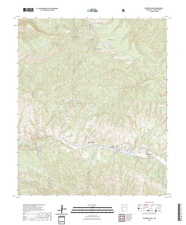
2023 Map of Copperas Peak
USGS Topo · Published 2023About this map
Lake Roberts Heights and the adjacent community of Trout Valley anchor the southern portion of this landscape, situated along the northern shore of Lake Roberts. This high-altitude region of the Gila National Forest is defined by the drainage systems of Sapillo Creek and Meadow Creek, which converge near the settlements. The presence of numerous water sources, including Meerschaum Spring and Alum Spring, suggests a reliance on scattered riparian pockets within the drier upland terrain.
Find a feature on this map
48 named features on this map. Tap any name to fly to it.
Don’t see what you’re looking for? This feature index may not catch every label — zoom into the map to look around manually.
Map Details
Editions of this 2023 Copperas Peak Map
This is the sole edition of this map. No revisions or reprints were ever made.
Other maps of this area

1909 · Silver City
USGS Topo · 1:125,000

1911 · Alum Mountain
USGS Topo · 1:125,000

1913 · Alum Mountain
USGS Topo · 1:125,000

1947 · Allie Canyon
USGS Topo · 1:24,000

1947 · Twin Sisters
USGS Topo · 1:24,000

1948 · Twin Sisters
USGS Topo · 1:24,000

1948 · Allie Canyon
USGS Topo · 1:24,000

1950 · Reading Mountain
USGS Topo · 1:24,000
1952 · Reading Mountain
USGS Topo · 1:24,000

1954 · Silver City
USGS Topo · 1:250,000