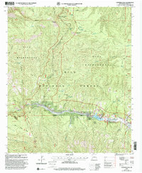
1999 Map of Copperas Peak
USGS Topo · Published 2002About this map
Gila Wilderness and Gila National Forest dominate this terrain, where the rugged peaks of the Gila Range meeting the canyon-cut waters of Sapillo Creek. The presence of the Meerschaum Mine and its namesake features, including Meerschaum Spring and Meerschaum Canyon, points to the area's specialized mineral history, specifically the extraction of sepiolite or "sea-foam" clay used for pipe-making.
Find a feature on this map
56 named features on this map. Tap any name to fly to it.
Don’t see what you’re looking for? This feature index may not catch every label — zoom into the map to look around manually.
Map Details
Editions of this 1999 Copperas Peak Map
This is the sole edition of this map. No revisions or reprints were ever made.
Other maps of this area

1909 · Silver City
USGS Topo · 1:125,000

1911 · Alum Mountain
USGS Topo · 1:125,000

1913 · Alum Mountain
USGS Topo · 1:125,000

1947 · Allie Canyon
USGS Topo · 1:24,000

1947 · Twin Sisters
USGS Topo · 1:24,000

1948 · Twin Sisters
USGS Topo · 1:24,000

1948 · Allie Canyon
USGS Topo · 1:24,000

1950 · Reading Mountain
USGS Topo · 1:24,000
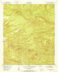
1952 · Reading Mountain
USGS Topo · 1:24,000

1954 · Silver City
USGS Topo · 1:250,000