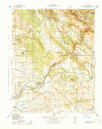
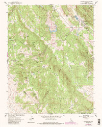
1942 Map of Copperopolis
USGS Topo · Published 1942About this map
Copperopolis stands as the primary hub of this 1940s-era landscape, where the hardrock mining legacy of the Mother Lode is evident through numerous named workings. Industrial activity is concentrated at sites like the Wilbur Womble Mine, Napoleon Mine, and the Alto Mine, while the physical geography is dominated by the massive Table Mountain and the canyon of the Stanislaus River. The southern portion of the map reveals a sophisticated water management system, featuring the Tulloch Ditch, South Ditch, and the South Distributing Main to support the local agriculture and infrastructure.
Find a feature on this map
103 named features on this map. Tap any name to fly to it.
Don’t see what you’re looking for? This feature index may not catch every label — zoom into the map to look around manually.
Map Details
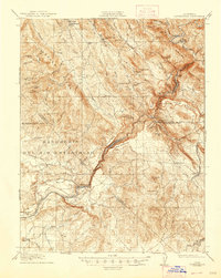
Editions of this 1942 Copperopolis Map
This is the sole edition of this map. No revisions or reprints were ever made.
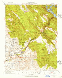
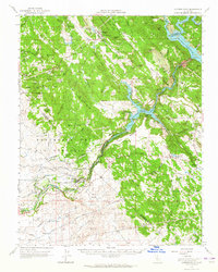
Historical Maps of Knights Ferry Through Time
6 maps found
Featured Locations
- Copper Cove Subdivision, CA
- Copper Cove Village, CA
- Copperopolis, CA
- Telegraph City, CA
- The Shores of Poker Flat, CA