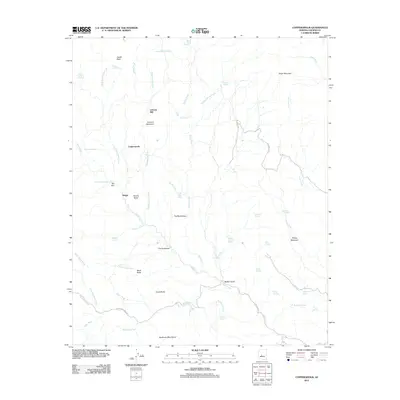
2011 Map of Copperopolis
USGS Topo · Published 2011About this map
Lehman Mill and the mountain that shares its name dominate this section of Yavapai County, where the desert landscape is defined by a dense network of drainages and named springs. The settlement of Copperopolis sits near the headwaters of Copperopolis Creek, indicating the area's mining history and its reliance on scattered water sources like Bradshaw Spring and Harry Knight Spring. Further south, the map identifies curious local landmarks such as The Rockhouse and The Doghouse, which sit among several notable landforms including Thoma Butte and Evans Butte. Transport in the region is facilitated by rural routes like Buckhorn Ranch Rd, connecting these remote outposts to the Buckhorn Mountains and the winding course of Castle Creek. The map provides a detailed account of the riparian geography, from Walker Gulch to the seasonal flows of Black Butte Wash and Whipsaw Creek.
Find a feature on this map
59 named features on this map. Tap any name to fly to it.
Don’t see what you’re looking for? This feature index may not catch every label — zoom into the map to look around manually.
Map Details
Editions of this 2011 Copperopolis Map
This is the sole edition of this map. No revisions or reprints were ever made.
Other maps of this area

1887 · Prescott
USGS Topo · 1:250,000

1892 · Prescott
USGS Topo · 1:250,000

1903 · Bradshaw Mountains
USGS Topo · 1:125,000

1903 · Congress
USGS Topo · 1:125,000

1904 · Congress
USGS Topo · 1:125,000

1947 · Crown King
USGS Topo · 1:62,500

1947 · Wagoner
USGS Topo · 1:62,500

1948 · Crown King
USGS Topo · 1:63,360

1948 · Wagoner
USGS Topo · 1:63,360

1950 · Wagoner
USGS Topo · 1:62,500