
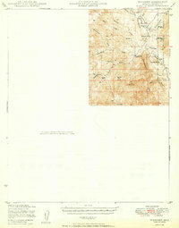
1950 Map of Wagoner
USGS Topo · Published 1950About this map
The Hassayampa River carves through this portion of Yavapai County, anchoring a landscape defined by ranching and high-desert water sources. In the late 1940s, the small settlement of Wagoner served as a local hub near the Diamond 2 Ranch, while Minnehaha sat further east within the boundaries of the Prescott National Forest. The presence of an Air Strip near the river suggests the increasing importance of aerial access in these remote reaches of the Arizona interior.
Find a feature on this map
30 named features on this map. Tap any name to fly to it.
Don’t see what you’re looking for? This feature index may not catch every label — zoom into the map to look around manually.
Map Details
Editions of this 1950 Wagoner Map
2 editions found
Other maps of this area

1887 · Prescott
USGS Topo · 1:250,000

1892 · Prescott
USGS Topo · 1:250,000

1903 · Bradshaw Mountains
USGS Topo · 1:125,000

1903 · Congress
USGS Topo · 1:125,000

1904 · Congress
USGS Topo · 1:125,000

1947 · Crown King
USGS Topo · 1:62,500

1947 · Mt. Union
USGS Topo · 1:62,500

1947 · Kirkland
USGS Topo · 1:62,500

1947 · Wagoner
USGS Topo · 1:62,500

1948 · Crown King
USGS Topo · 1:63,360