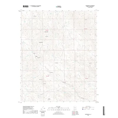
2018 Map of Copperopolis
USGS Topo · Published 2018About this map
Lehman Mill stands as a primary landmark in this high-desert mining and ranching landscape of Yavapai County. The area is defined by a dense network of seasonal drainages including Castle Cr and Banty Cr, which carve through a terrain punctuated by distinct peaks like Lehman Mtn, Silver Mtn, and the Buckhorn Mountains. The settlement patterns at Copperopolis and Briggs suggest a history of resource extraction, further indicated by the presence of numerous springs such as Bradshaw Spring and Tussock Spring which were vital for survival in this arid environment. Unique landform labels like The Box, The Rockhouse, and The Doghouse provide specific points of interest for local historians studying the naming conventions and vernacular geography of this portion of the Arizona interior during the early twenty-first century.
Find a feature on this map
61 named features on this map. Tap any name to fly to it.
Don’t see what you’re looking for? This feature index may not catch every label — zoom into the map to look around manually.
Map Details
Editions of this 2018 Copperopolis Map
This is the sole edition of this map. No revisions or reprints were ever made.
Other maps of this area

1887 · Prescott
USGS Topo · 1:250,000

1892 · Prescott
USGS Topo · 1:250,000

1903 · Bradshaw Mountains
USGS Topo · 1:125,000

1903 · Congress
USGS Topo · 1:125,000

1904 · Congress
USGS Topo · 1:125,000

1947 · Crown King
USGS Topo · 1:62,500

1947 · Wagoner
USGS Topo · 1:62,500

1948 · Crown King
USGS Topo · 1:63,360

1948 · Wagoner
USGS Topo · 1:63,360

1950 · Wagoner
USGS Topo · 1:62,500