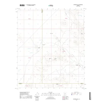
2018 Map of Copperosity Hills
USGS Topo · Published 2018About this map
The Kohatk Valley and Kaka Valley converge in this high-desert landscape, where ephemeral drainages like Kohatk Wash and Kaka Wash dictate the movement of water across the arid terrain. The settlement of Totopitk sits near the junction of these desert washes, while Chiapuk is located further south along Indian Rte 242. This remote corridor is defined by prominent topographical features, including the eponymous Copperosity Hills and the distinct formation of Cathedral Rock. These peaks rise above the valley floor between the larger Vekol Mountains to the east and the Cimarron Mountains to the south. The convergence of Maricopa, Pinal, and Pima counties within this small area highlights the complex jurisdictional boundaries that cross this sparsely populated desert region.
Find a feature on this map
21 named features on this map. Tap any name to fly to it.
Don’t see what you’re looking for? This feature index may not catch every label — zoom into the map to look around manually.
Map Details
Editions of this 2018 Copperosity Hills Map
This is the sole edition of this map. No revisions or reprints were ever made.
Other maps of this area

1941 · Vekol Mountains
USGS Topo · 1:62,500

1942 · Vekol Mountains
USGS Topo · 1:62,500

1953 · Ajo
USGS Topo · 1:250,000

1957 · Ajo
USGS Topo · 1:250,000

1958 · Ajo
USGS Topo · 1:250,000

1958 · Kaka
USGS Topo · 1:62,500

1962 · Ajo
USGS Topo · 1:250,000

1963 · Ajo
USGS Topo · 1:250,000

1963 · Gu Achi
USGS Topo · 1:62,500

1963 · Cimarron Peak
USGS Topo · 1:62,500