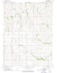
1973 Map of Cora
USGS Topo · Published 1975About this map
Cora and Womer anchor this agricultural landscape in Smith County during the early 1970s. The terrain is defined by a dense network of drainage systems, including White Rock Creek and Pawnee Creek, which carve through the plains. Local civic life is centered around the Community Center and the Townhall, while the Cedar Hill Cem provides a primary point of interest for those tracing family roots in the township. Industrial and infrastructure footprints are visible through several Quarries and a Radio Tower near the settlement of Cora. The map also documents rural utilities like the Sewage Disposal plant and various water Wells that sustained the local farming economy. This survey captures a moment of established rural stability before the modernization of regional road systems and changes in small-town municipal functions.
Find a feature on this map
25 named features on this map. Tap any name to fly to it.
Don’t see what you’re looking for? This feature index may not catch every label — zoom into the map to look around manually.
Map Details
Editions of this 1973 Cora Map
This is the sole edition of this map. No revisions or reprints were ever made.
Other maps of this area

1893 · Smith Center
USGS Topo · 1:125,000

1897 · Red Cloud
USGS Topo · 1:125,000

1940 · Red Cloud
USGS Topo · 1:62,500

1942 · Red Cloud
USGS Topo · 1:62,500

1955 · Grand Island
USGS Topo · 1:250,000

1955 · Beloit
USGS Topo · 1:250,000

1957 · Grand Island
USGS Topo · 1:250,000

1958 · Grand Island
USGS Topo · 1:250,000

1959 · Beloit
USGS Topo · 1:250,000
1973 · Reamsville
USGS Topo · 1:24,000