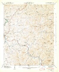
1947 Map of Corbin Knob
USGS Topo · Published 1947About this map
Franklin serves as the focal point for this 1947 study, where the Little Tennessee River meets the Cullasaja River. The landscape is defined by the Nantahala National Forest and a series of high ridges, including the Cowee Mountains and Sugar Fork Mountain. Local industry and community life are marked by several small settlements like Higdonville and Ellijay, alongside landmarks such as Berry Mill and the Nikwasi Indian Mound.
Find a feature on this map
111 named features on this map. Tap any name to fly to it.
Don’t see what you’re looking for? This feature index may not catch every label — zoom into the map to look around manually.
Map Details
Editions of this 1947 Corbin Knob Map
2 editions found
Other maps of this area

1891 · Cowee
USGS Topo · 1:125,000

1897 · Cowee
USGS Topo · 1:125,000

1907 · Cowee
USGS Topo · 1:125,000

1933 · Bryson
USGS Topo · 1:62,500

1935 · Franklin
USGS Topo · 1:24,000

1935 · Prentiss
USGS Topo · 1:24,000

1935 · Cullowhee
USGS Topo · 1:24,000

1935 · Scaly
USGS Topo · 1:24,000

1935 · Glenville
USGS Topo · 1:24,000

1935 · Corbin Knob
USGS Topo · 1:24,000