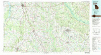
1981 Map of Cordele
USGS Topo · Published 1982About this map
Lake Blackshear and the Georgia Veterans Memorial State Park anchor the western edge of this South Georgia landscape, where the Flint River flows through Crisp and Worth counties. This 1981 survey reveals a region defined by its agricultural research and extensive rail network, including the Georgia Southern and Florida and the Seaboard Coast Line Railroad which intersect at major transit hubs. To the south, the University of Georgia Research Center sits near Sylvester, highlighting the area's importance to the state's agricultural economy.
Find a feature on this map
101 named features on this map. Tap any name to fly to it.
Don’t see what you’re looking for? This feature index may not catch every label — zoom into the map to look around manually.
Map Details
Editions of this 1981 Cordele Map
This is the sole edition of this map. No revisions or reprints were ever made.
Other maps of this area

1953 · Dothan
USGS Topo · 1:250,000

1953 · Waycross
USGS Topo · 1:250,000

1954 · Dothan
USGS Topo · 1:250,000

1955 · Dothan
USGS Topo · 1:250,000

1955 · Phenix City
USGS Topo · 1:250,000

1956 · Albany East
USGS Topo · 1:24,000

1956 · Baconton
USGS Topo · 1:62,500

1956 · Sylvester
USGS Topo · 1:62,500

1956 · Doerun
USGS Topo · 1:62,500

1956 · Albany
USGS Topo · 1:62,500