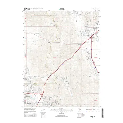
2015 Map of Cordelia
USGS Topo · Published 2015About this map
Elkhorn Peak and Sulphur Springs Mtn anchor the high ground of the North Bay, overlooking a landscape defined by the intersection of the Napa Valley and the Suisun plains. The early 21st-century footprint of American Canyon and Cordelia Junction reveals a complex infrastructure where Interstate highways follow historical corridors through Jameson Canyon. Along the southern margin, residential developments like Chabot Terrace, Flosden Acres, and Harry Floyd Terrace border the northern reaches of Vallejo, while Lake Chabot and the Summit Reservoir provide critical water management for the growing population. To the east, the tidelands of Cordelia Slough meet the foothills, while the rural character of Sky Valley and Page Flat persists between the more densely settled corridors. The map records a significant era of suburban expansion and transportation engineering, connecting the agricultural traditions of Creston with the modern logistics hubs emerging near the Solano County and Napa County line.
Find a feature on this map
195 named features on this map. Tap any name to fly to it.
Don’t see what you’re looking for? This feature index may not catch every label — zoom into the map to look around manually.
Map Details
Editions of this 2015 Cordelia Map
This is the sole edition of this map. No revisions or reprints were ever made.
Other maps of this area

1896 · Carquinez Strait
USGS Topo · 1:62,500

1898 · Karquines
USGS Topo · 1:62,500

1901 · Karquines
USGS Topo · 1:62,500

1902 · Napa
USGS Topo · 1:125,000

1916 · Mare Island
USGS Topo · 1:62,500

1921 · Mt. Vaca
USGS Topo · 1:62,500

1940 · Carquinez Strait
USGS Topo · 1:62,500

1942 · Mare Island
USGS Topo · 1:62,500

1942 · Carquinez
USGS Topo · 1:62,500

1942 · Sonoma
USGS Topo · 1:62,500