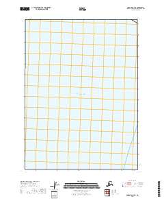
2018 Map of Cordova A-3 SE
USGS Topo · Published 2018About this map
The Gulf of Alaska dominates this maritime survey, illustrating a vast expanse of open water off the Alaskan coast. This particular quadrant of the Gulf is defined by its lack of landmass or bathymetric features, serving primarily as a cartographic record of the maritime boundary and the Public Land Survey System grid extended over the water. The upper northeastern corner identifies township t20s r4e, providing a spatial reference point for maritime navigation and administrative boundaries within the Valdez-Cordova Census Area. Unlike many terrestrial maps, this sheet emphasizes the sheer scale of the Gulf, documenting the coordinate positions and grid sections that organize this remote stretch of the North Pacific.
Find a feature on this map
5 named features on this map. Tap any name to fly to it.
Don’t see what you’re looking for? This feature index may not catch every label — zoom into the map to look around manually.
Map Details
Editions of this 2018 Cordova A-3 SE Map
This is the sole edition of this map. No revisions or reprints were ever made.
Other maps of this area

1948 · Cordova
USGS Topo · 1:250,000

1948 · Middleton Island
USGS Topo · 1:250,000

1950 · Middleton Island
USGS Topo · 1:250,000

1950 · Cordova A-2
USGS Topo · 1:63,360

1951 · Cordova
USGS Topo · 1:250,000

1953 · Cordova A-2
USGS Topo · 1:63,360
1955 · Middleton Island
USGS Topo · 1:250,000

1959 · Cordova
USGS Topo · 1:250,000
1965 · Middleton Island
USGS Topo · 1:250,000
1988 · Cordova A-3
USGS Topo · 1:63,360