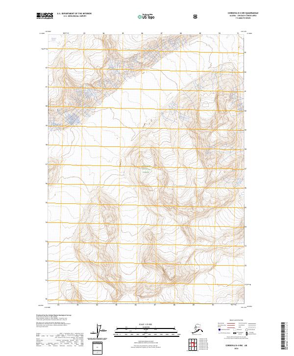
2024 Map of Cordova D-4 NW
USGS Topo · Published 2024About this map
Tasnuna Glacier dominates the northern reaches of this high-altitude landscape, where ice and contour lines describe a complex glacial environment. Much of the southern and central terrain falls within the boundaries of the Chugach National Forest, a vast wilderness managed for conservation. This 2024 survey reflects the modern geospatial mapping of the Chugach Census Area, detailing the high peaks and drainage patterns of the coastal mountains. The map primarily serves to document the physical geography of the region, emphasizing the dramatic shifts in elevation and the persistent ice fields that define this part of the Alaskan interior.
Find a feature on this map
6 named features on this map. Tap any name to fly to it.
Don’t see what you’re looking for? This feature index may not catch every label — zoom into the map to look around manually.
Map Details
Editions of this 2024 Cordova D-4 NW Map
This is the sole edition of this map. No revisions or reprints were ever made.
Other maps of this area

1948 · Cordova
USGS Topo · 1:250,000

1950 · Cordova D-5
USGS Topo · 1:63,360

1951 · Cordova
USGS Topo · 1:250,000

1951 · Cordova D-4
USGS Topo · 1:63,360

1952 · Valdez
USGS Topo · 1:250,000

1953 · Cordova D-5
USGS Topo · 1:63,360

1953 · Cordova D-4
USGS Topo · 1:63,360

1953 · Valdez A-4
USGS Topo · 1:63,360

1953 · Valdez A-5
USGS Topo · 1:63,360

1959 · Cordova
USGS Topo · 1:250,000