
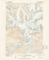
1953 Map of Cordova D-5
USGS Topo · Published 1954About this map
The Gravina River winds through a deep, ice-carved valley in this mid-century survey of the Chugach Mountains. Dominated by the massive Woodworth Glacier in the northeast, the landscape is defined by the shifting movement of ice, marked extensively with numerous Crevasses across the high-elevation fields. This 1953 mapping effort, based on aerial photography from 1950, provides a precise record of the glacial extent and river drainage patterns within the Chugach National Forest before modern climate shifts. The Forest Boundary (Approximate) is delineated across the southern ridges, separating the protected timber and alpine lands from the surrounding terrain. With a focus on topographic elevation and ice morphology, the map serves as a vital record of this remote Alaskan environment during a period of active aerial surveying by the U.S. Geological Survey.
Find a feature on this map
6 named features on this map. Tap any name to fly to it.
Don’t see what you’re looking for? This feature index may not catch every label — zoom into the map to look around manually.
Map Details
Editions of this 1953 Cordova D-5 Map
2 editions found
Other maps of this area

1948 · Cordova
USGS Topo · 1:250,000

1950 · Cordova C-6
USGS Topo · 1:63,360

1950 · Cordova C-4
USGS Topo · 1:63,360

1950 · Cordova D-5
USGS Topo · 1:63,360

1951 · Cordova
USGS Topo · 1:250,000

1951 · Cordova C-5
USGS Topo · 1:63,360

1951 · Cordova D-6
USGS Topo · 1:63,360

1951 · Cordova D-4
USGS Topo · 1:63,360

1951 · Valdez A-6
USGS Topo · 1:63,360

1952 · Valdez
USGS Topo · 1:250,000