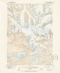
1953 Map of Cordova D-5
USGS Topo · Published 1954About this map
Chugach Mountains peaks dominate this high-altitude topographic study, defining a landscape of ice and stone in the early 1950s. The northern reaches of the Chugach National Forest are clearly delineated by the Forest Boundary (Approximate), marking the transition from protected federal lands into the surrounding wilderness. The drainage of the Gravina River carves through the southern portion of the sheet, fed by the massive Woodworth Glacier to the east. Extensive Crevasses are mapped across the glacial surfaces, providing a detailed record of the movement and structure of the ice fields during this era of aerial photogrammetric survey. This map serves as a primary source for understanding the mid-century extent of these glacial systems before decades of environmental change.
Find a feature on this map
7 named features on this map. Tap any name to fly to it.
Don’t see what you’re looking for? This feature index may not catch every label — zoom into the map to look around manually.
Map Details
Editions of this 1953 Cordova D-5 Map
2 editions found

Other maps of this area

1948 · Cordova
USGS Topo · 1:250,000

1950 · Cordova C-6
USGS Topo · 1:63,360

1950 · Cordova C-4
USGS Topo · 1:63,360

1950 · Cordova D-5
USGS Topo · 1:63,360

1951 · Cordova
USGS Topo · 1:250,000

1951 · Cordova C-5
USGS Topo · 1:63,360

1951 · Cordova D-6
USGS Topo · 1:63,360

1951 · Cordova D-4
USGS Topo · 1:63,360

1951 · Valdez A-6
USGS Topo · 1:63,360

1952 · Valdez
USGS Topo · 1:250,000