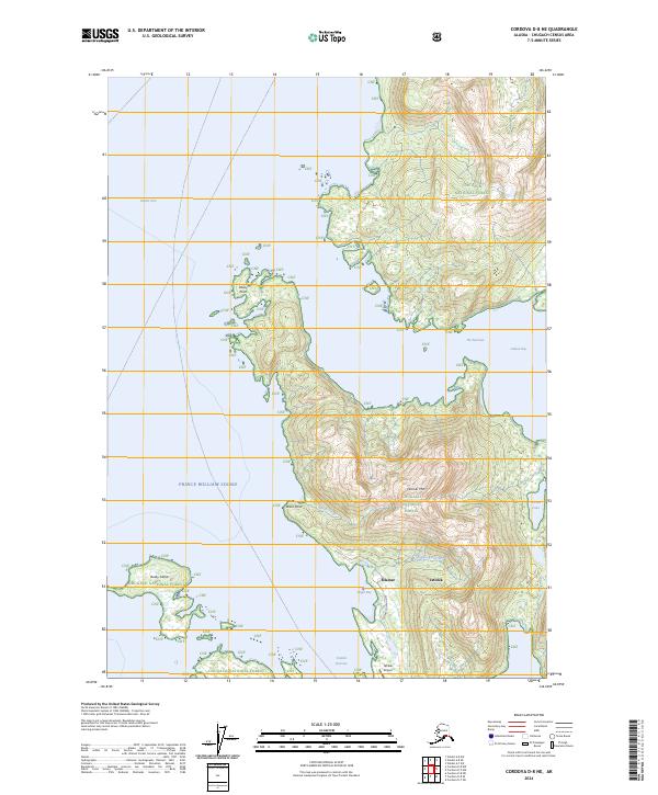
2024 Map of Cordova D-8 NE
USGS Topo · Published 2024About this map
Chugach National Forest provides the setting for this coastal survey of the eastern Prince William Sound. The settlements of Tatitlek and Ellamar occupy the shoreline near Virgin Bay, connected by Copper Queen Drive. This landscape is defined by the sharp transition from the maritime waters of the Valdez Arm and Galena Bay to the steep relief of Ellamar Mtn. The transport pattern of the region relies on the water and the air, centered around the Tatitlek Narrows and the Tatitlek Airport. To the south, Busby Island sits across from Rocky Point, while the interior terrain is marked by freshwater features like Turner Lake and the drainages of Black Creek and Gladhaugh Creek. The map documents a sparsely populated but vital coastal corridor where the mountains of the Chugach Range meet the intricate inlets of the sound.
Find a feature on this map
23 named features on this map. Tap any name to fly to it.
Don’t see what you’re looking for? This feature index may not catch every label — zoom into the map to look around manually.
Map Details
Editions of this 2024 Cordova D-8 NE Map
This is the sole edition of this map. No revisions or reprints were ever made.
Other maps of this area

1948 · Cordova
USGS Topo · 1:250,000

1950 · Cordova D-7
USGS Topo · 1:63,360

1951 · Cordova
USGS Topo · 1:250,000

1951 · Cordova D-8
USGS Topo · 1:63,360

1952 · Valdez
USGS Topo · 1:250,000

1952 · Cordova D-8
USGS Topo · 1:63,360

1952 · Cordova D-7
USGS Topo · 1:63,360

1959 · Cordova
USGS Topo · 1:250,000

1960 · Valdez A-8
USGS Topo · 1:63,360

1960 · Valdez A-7
USGS Topo · 1:63,360