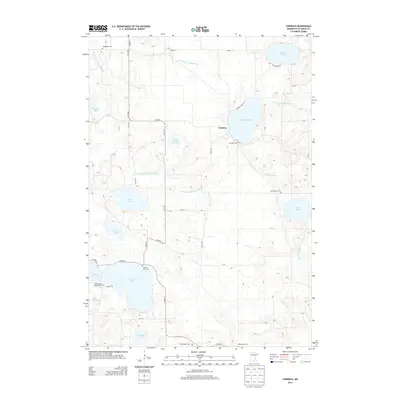
2013 Map of Cordova
USGS Topo · Published 2013About this map
Cordova sits as a quiet settlement amidst a landscape defined by its numerous water bodies and agricultural drainageways in this 2013 survey. The area is heavily marked by man-made alterations to the natural hydrology, specifically through features like County Ditch Number Fiftyone and County Ditch Number Sixtyfour, which serve to manage the land around the region's prominent lakes. Notable among these are Lake Jefferson, German Lake, and Gorman Lake. For those researching local heritage, the map is remarkably dense with burial sites including Gorman Cem, Sabre Lake Cem, and the uniquely named Phebe Jones Lakeside Cem on the shores of German Lake. The presence of Dodd Rd and various county highways like Co Hwy-11 connect these rural lake communities, while the Cannon River meanders through the eastern portion of the quadrangle.
Find a feature on this map
50 named features on this map. Tap any name to fly to it.
Don’t see what you’re looking for? This feature index may not catch every label — zoom into the map to look around manually.
Map Details
Editions of this 2013 Cordova Map
This is the sole edition of this map. No revisions or reprints were ever made.
Other maps of this area

1950 · Mankato East
USGS Topo · 1:62,500

1951 · Mankato East
USGS Topo · 1:62,500

1953 · Saint Paul
USGS Topo · 1:250,000

1959 · Saint Paul
USGS Topo · 1:250,000

1965 · Cleveland
USGS Topo · 1:24,000

1965 · St Thomas
USGS Topo · 1:24,000

1966 · Montgomery
USGS Topo · 1:24,000

1966 · Waterville
USGS Topo · 1:24,000

1966 · Cordova
USGS Topo · 1:24,000

1966 · Elysian
USGS Topo · 1:24,000